This post will updated as new forecasts came in (follow the latest forecasts from the ECMWF here). Latest update: 10 January, 09:30 UTC
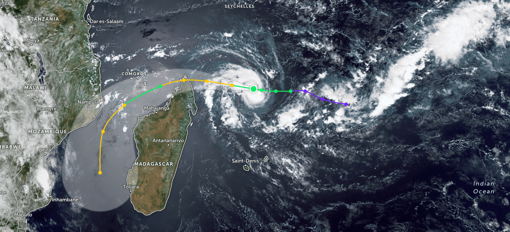
The tropical storm Dikeledi (picture from Zoom Earth on 9 January) is moving fast towards the northern part of Madagascar and is expected to make landfall there on Saturday. The forecast below was from 06:00 UTC on 9 January:

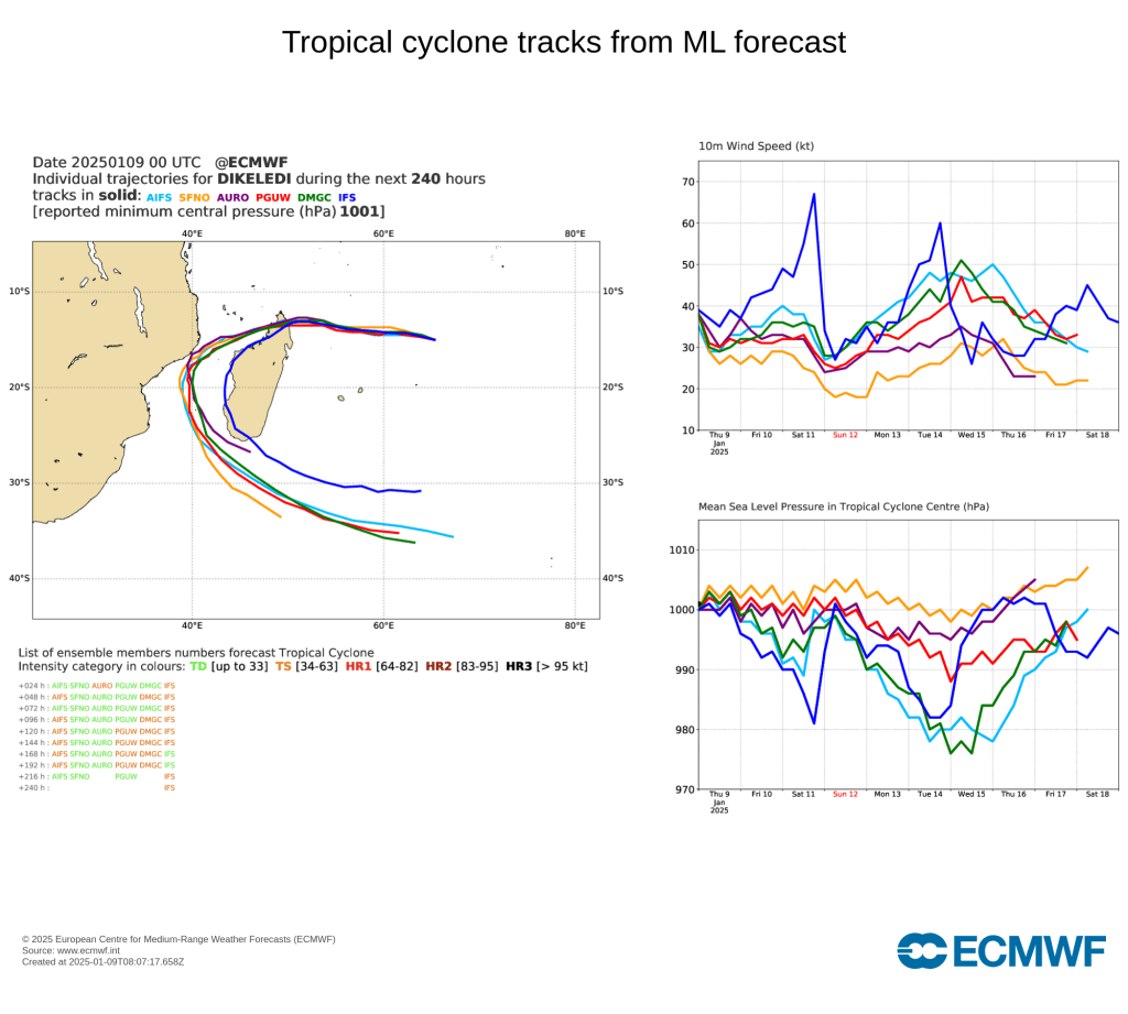
It was not a very strong storm at that time, but the forecasts indicated that it would curve towards the south and re-intensify when it reaches the Mozambique Channel.
The forecast issued only 18 hours later (at 00 UTC on 10 January) indicated a substantially stronger cyclone and a changed track:
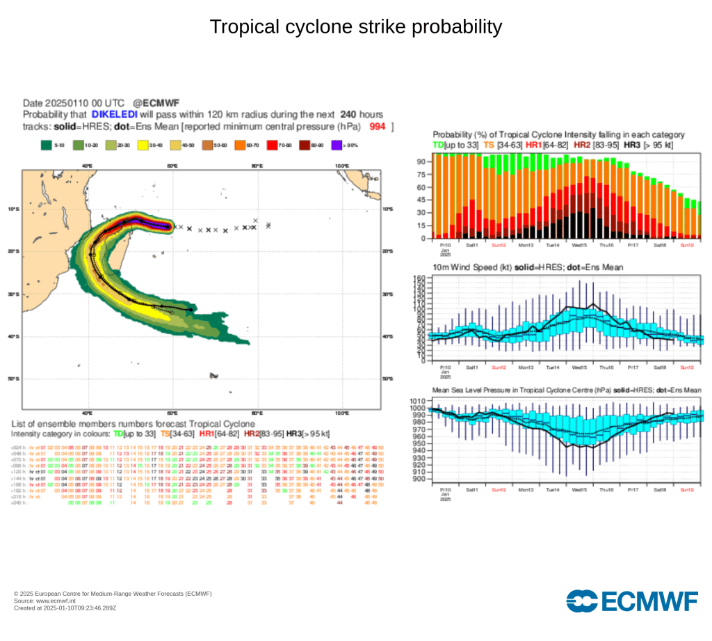
In this forecast the cyclone was predicted to develop into a Category 3 hurricane by Tuesday/Wednesday.
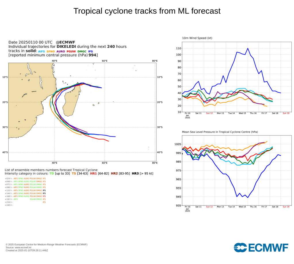
It has been fascinating to monitor the differences between the machine learning models and the standard prediction model, IFS (shown in blue below). The first image below displays the predicted tracks as of 00 UTC on 9 January, while the second image shows these predictions 24 hours later. It is striking that the IFS model adjusted its predictions to align more closely with those of the ML models. Additionally, the westward shift and the prolonged presence over the Mozambique Channel are obvious reasons for the strengthening in the latest forecast.
One of our aims in ACACIA is to investigate whether the ML models can be trusted; and if not, how they can be improved. The devastating cyclone Chido in December was not well forecast by the ML models.

Leave a comment