
By Scott Bremer, WP1 lead
In November 2024, some members of the ACACIA project team visited Madagascar for a preliminary study of the Sofia region case, and a first glimpse at how the communities there live with cyclones, storms and flooding. Our visit was timed to the cusp of the wet season, with rains expected from late November and wild weather from January to March or even April.
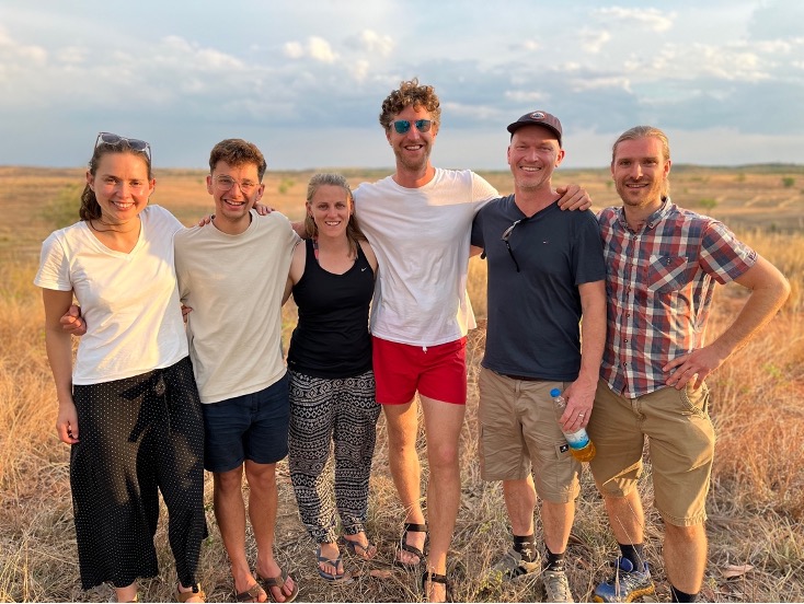
Ten project scientists converged on Madagascar, but owing to the fickle flows of international plane travel, we found ourselves divided into two teams; one team conferring with the central governing agencies in the capital of Antananarivo, and a field team heading to the Sophia region, in the North of Madagascar, and the small city of Antsohihy. I was in the 8-strong field team, each of us first finding our own way to the nearby exotic island of Nosy Be.
Stepping out of the small twin-rotor plane, I was met by a deafening hiss of cicadas from the jungle that pressed in around the landing strip, and exuded plumes of steam. A jeep drove me through the jungle until it opened on the township of Hellville, circling a pearly-white cemetery of Parisian-style tombs, festooned with flowers picked through by stray dogs. Collecting the other members of the team, we boarded a speedboat, which cut a path through sailboats, ferry’s and canoes to the jungled hills of the mainland, where we filled up two waiting jeeps and continued the 140km to Antsohihy.
That drive took us around 8 hours, negotiating a road so pot-marked as to resemble a battlefield, in a fight between tarmac and surface flooding. Nearing our destination at dusk, the sky billowed with clouds like purple smoke, lightning stabbed the desert around us, and a great deluge of rain turned the road into a network of muddy ponds. This, we would find, was a pattern that unfolded each day that week.
That first night, over Zebu steaks with our hosts from Red Cross, we designed questions that we would pose to people in the surrounding villages, to begin to frame the project’s work. We came up with a focus group set-up that encouraged villagers to first recount stories about what happened before, during and after a recent storm event, and then draw a calendar – like a wheel – of their year. The calendar was supposed to show the storm season alongside other important dates and periods of the year for the villagers.
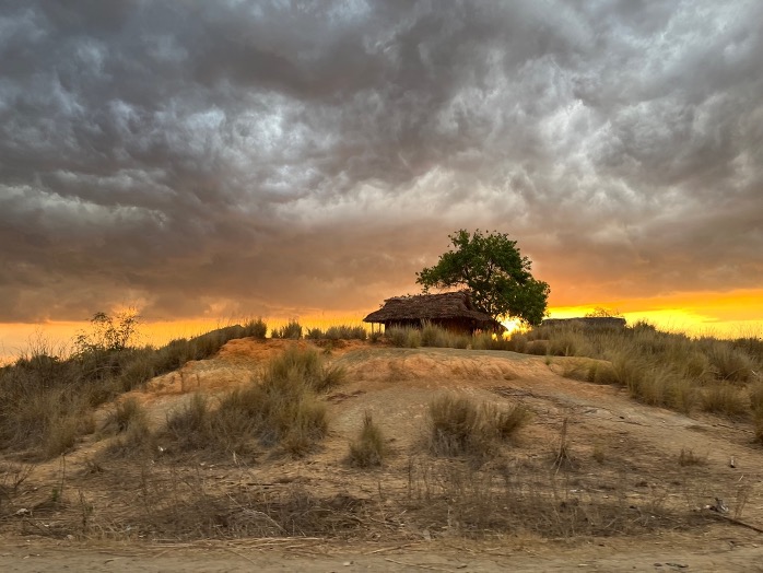
The first day in the field started with visits to some government leaders in the city, finishing with a visit to the local airport, which now only receives private planes, and hosts the aging weather station for the region. Pulling up to the sun-baked stucco building, I couldn’t help but think of Camus’ book L’Etranger, and the blinding white sunlight that covered this place. Antoine from the local branch of Météo Madagascar led us to a shady room, filled with exemplars of romantic-looking measurement apparatus from the ‘belle epoque’, and a torn map of Madagascar from halfway through last century. He walked us out to a straw field to inspect the rain gauge and told us about how the recently-deceased weather man for the region had, over the past 24 years, learned to read the clouds to predict floods.
Then we divided into three jeeps and made our ways into the villages of the hinterland. Arriving at our first village, I expected to find a group of 5-10 people. But when we parked under a mango tree, what seemed like the whole village converged on us. The crowd around us – from mothers nursing babies to old gentlemen handling their hats – called out harrowing stories of the storms that passed through their place and left the village and its rice patties under water ‘half as high as the mango trunk.’ When it came to drawing the calendar we had to improvise, since it would be impossible to draw a calendar big enough for the whole crowd to see. At that first village, we asked volunteers to form into a large circle, which represented the year, and asked them to move to the parts of the year – of the circle – that mattered to them. Later that afternoon, in another village’s community hall, we formed a human calendar with people holding sheets of paper representing the months, as the dusk deluge hammered on the roof.

The following day we conducted nine more focus groups in nine other villages, and neighbourhoods. That morning was memorable. After breakfasting at 5.30 on doughnuts and coffee from a roadside stall, we turned off into a road that might have been a riverbed, so deeply runnelled that it was like a tree trunk. That road suddenly opened onto a town square, ringed with mud brick buildings and mango trees, with a crumbling concrete pavilion and a statue of the country of Madagascar in the centre. There we conducted a focus group on the steps of the town hall with perhaps 150 people, finishing with the chief of the village – a young mother – urging us not to forget their village the next time a storm comes, before looking us square in the eyes with a smile and saying, in English, ‘Thank you very much.’ Afterwards we drove over dusty fields to a hamlet cresting a small hill above the dry riverbed – a haven from the floods for most in the area – and held a focus group in the little town square, also marked by a statue of Madagascar island, and a single flagpole. The villagers there pressed into the narrow shadows cast by the mud-brick buildings, while I sketched a calendar in the dust in front of that statue.
What did we learn from this preliminary study? We saw that the communities of Sofia have a lot of shared references for understanding and relating to the storm season. That January to March is at once the most vital period for the rains that water their crops, and a period that can bring terrifying storms and destruction. And that this period is punctuated by some common cultural markers, from the Day of the Dead on the 2nd of November, via New Year’s Eve, to Women’s Day in the 8th of March. At the same time, each village revealed unique repertoires for anticipating and coping with storms and floods in their own way. While some strategies, like using radio warnings, were wide-spread, others used their own novel approaches like capturing the first flow of floods, or roof water technologies, or effecting a hurried early harvest.
In this project we will need to work closely with Red Cross Madagascar and their network of volunteers across these villages, to compile these strategies into a repertoire that can be imparted to people across the region.

Leave a comment